One system, zoned from base to precious metals.
A 100%-owned, 76.25 km² property over a confirmed 5 × 8 km mineralized corridor in the Taltson Magmatic Zone — a district-scale system validated to at least 200 m depth.
Zinc & lead
The central Shaft Zone — the historic high-grade Zn-Pb intercepts.
Copper & silver
Copper and elevated silver in the intermediate structural corridors.
Gold & silver
Precious metals in cooler splay-fault targets — a historic 30.2 g/t gold sample at MCO.*
Validated 200 m+
Deep-seated faults correlate with known targets, pointing to tonnage potential at depth.
Halted in 1952 — by markets, not geology.
Developed extensively after WWII, O'Connor Lake was poised for production before a global collapse in zinc and lead prices forced it into care and maintenance. The high-grade Shaft Zone was proven; the geology was never the problem.
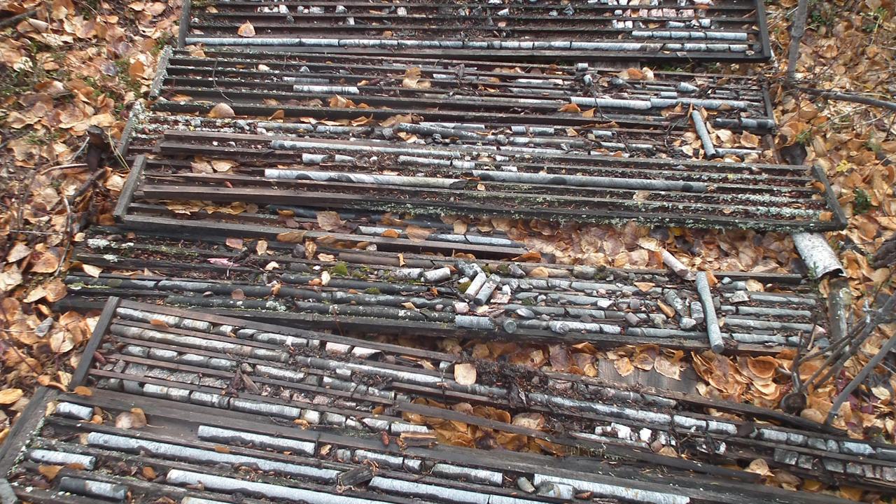
Sitting roughly 185 km southeast of Yellowknife and 150 km east of Hay River, the property retains legacy drill core and the footprint of its historic underground workings, largely untouched by modern exploration for over seventy years. The surface headframe has since been removed, but access remains straightforward — via the all-weather road corridor between Hay River and Fort Resolution, the same infrastructure that served the nearby Pine Point district, one of the world's great past-producing zinc-lead mines.
Today, Taltson is the first to apply airborne magnetics, 3D geological modelling and precision geochemistry across the system, building a modern, district-scale model of the Taltson Magmatic Zone.
Well-located and road-accessible.
In the South Slave region of the Northwest Territories, on the Pine Point road corridor — with clean Taltson hydro power on the doorstep.
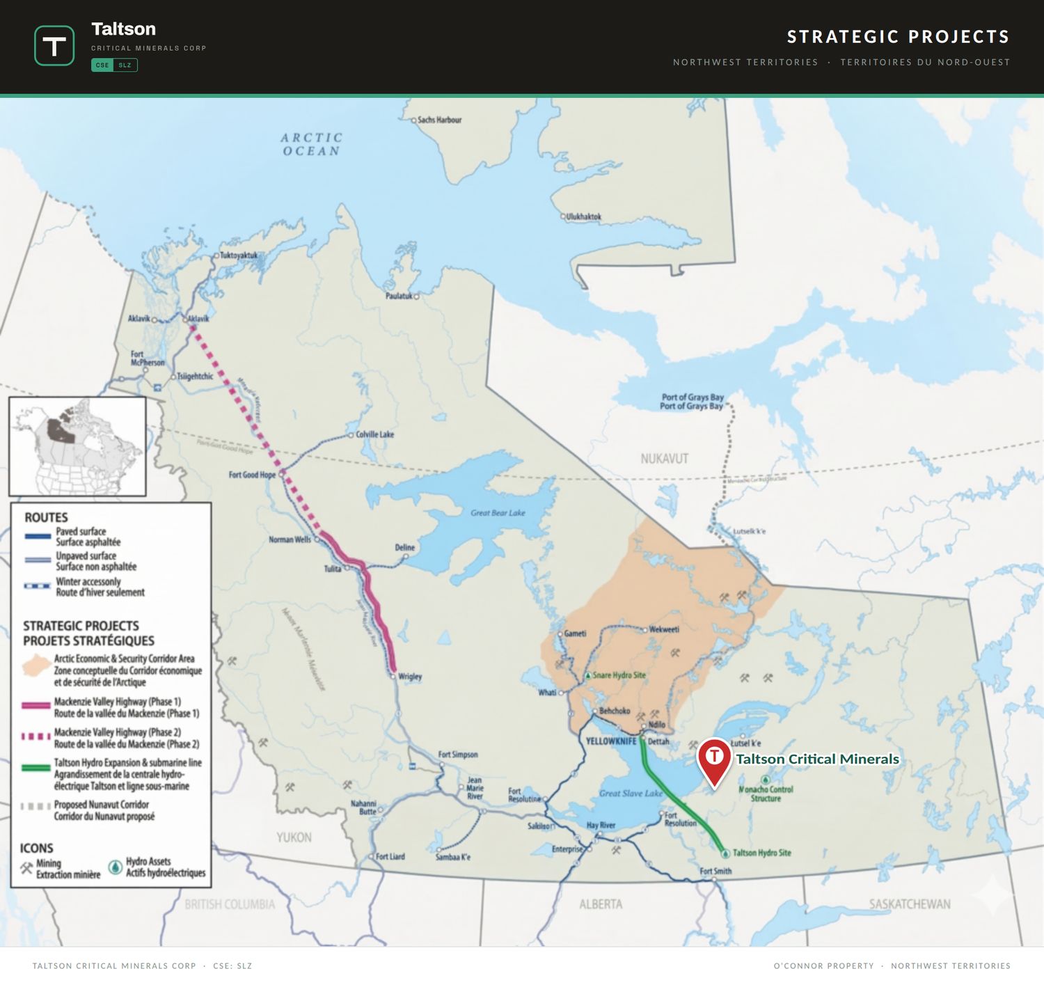
A consolidated 76 km² land package.
Ten mineral claims (MWK 1–10) surrounding the original NT-0008 mining lease — fully consolidated and 100%-owned following the Collaboration Agreement with the Northwest Territory Métis Nation.
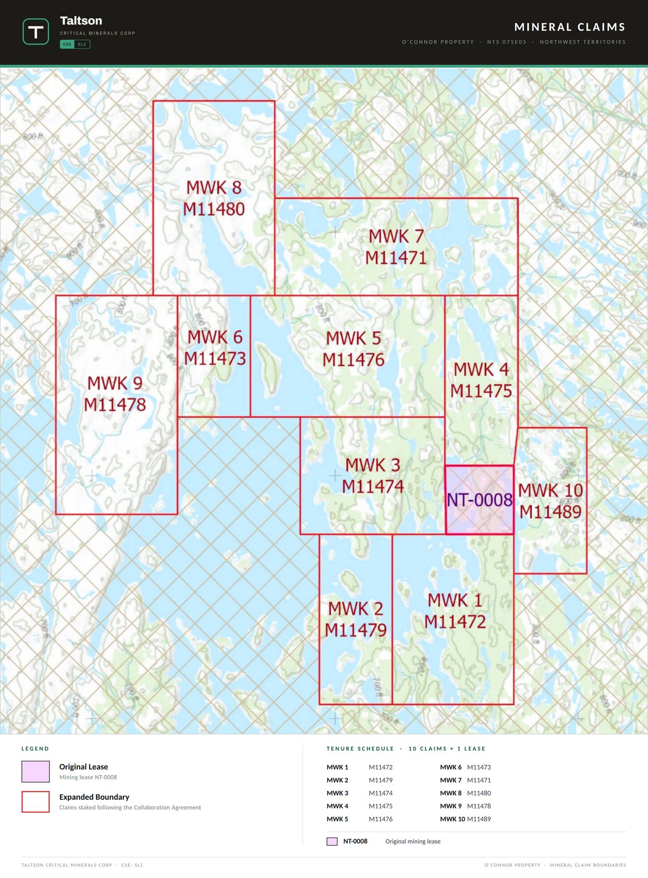
The MWK 1–10 claims consolidate the ground around the original NT-0008 mining lease into a single, contiguous 76.25 km² package.
Fully consolidated and wholly owned, staked following the Collaboration Agreement with the Northwest Territory Métis Nation.
South Slave region, on the Taltson Magmatic Zone — the geological trend the company is named for.
Structures that line up — from surface to depth.
Airborne magnetics reveal a network of deep-seated lineaments. Known high-grade showings — including BSM #1, BSM #2 and the historic O'Connor Shaft — align with these corridors, and inverted susceptibility models confirm they persist to at least 200 m depth.
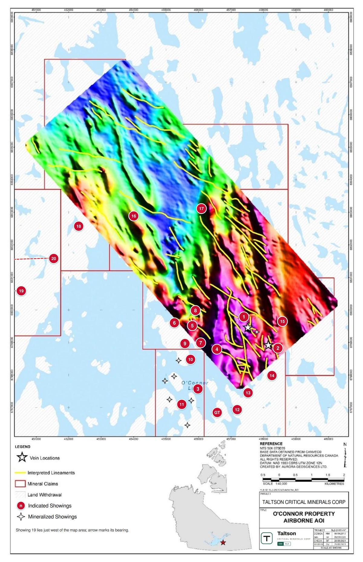
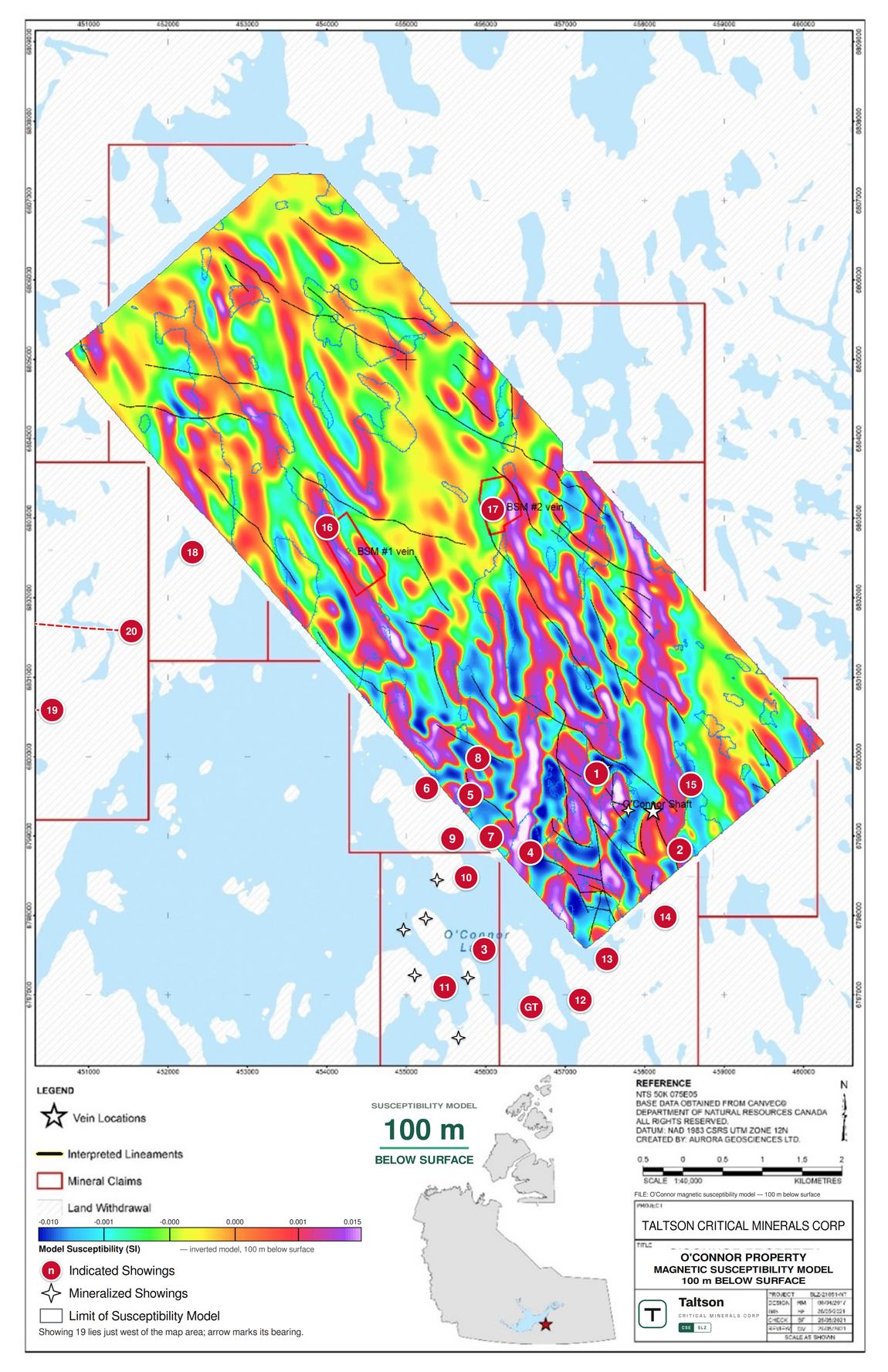
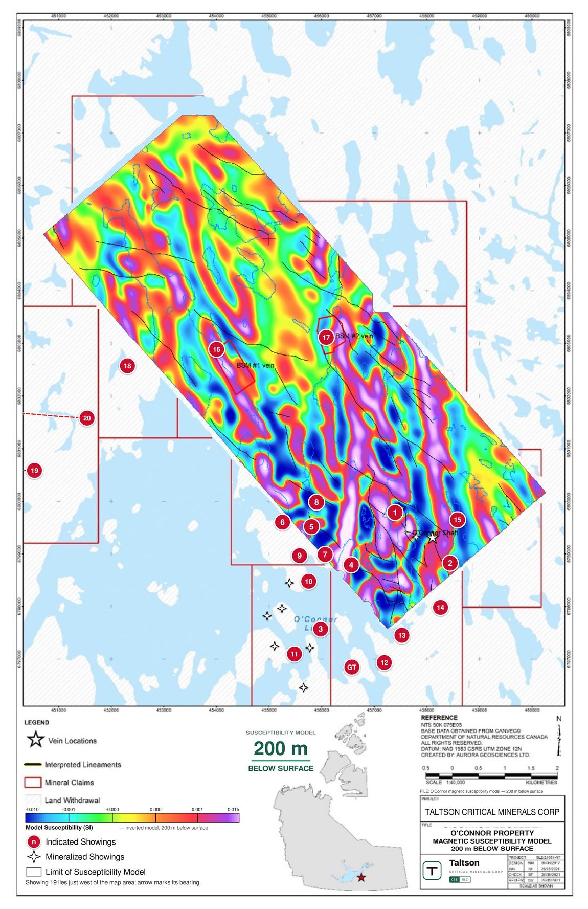
Click any panel to view the full map, and open its companion legend (PDF).
The district thesis, confirmed with direct evidence.
Laboratory results from the late-2025 geological review returned high-grade, multi-element mineralization across new structures kilometres from the historic Shaft Zone.
A disciplined, data-driven path to the drill bit.
Rather than drilling on hope, the program is sequenced so broad data narrows the search before a single metre is drilled — turning four seasons of groundwork into ranked, drill-ready targets.
Four seasons of groundwork
- Geological mapping & geochemistry
- Identified the 5 × 8 km corridor
- Jan 2026 assays validate district scale
880 line-km airborne EM
- Maps subsurface conductivity
- Pinpoints remobilized base-metal sulphides
- Ranks the best ground for follow-up
Ground-truth & diamond drilling
- Focused field campaign over top anomalies
- GPS magnetics & EM on priority targets
- Sets the stage for the drill bit